Eye in the Sky, Eyes on the Ground

How the change in colour of a pixel on a screen can set off a series of events that leads to the empowerment of local communities to conserve their globally important forest.
For people across Asia and the Western Pacific, the destruction and disappearance of tropical forests is no secret or surprise. Zooming in on Indonesia, Malaysia, Papua New Guinea and the Philippines reveals a grand total of over 154 million hectares, many recognised as Key Biodiversity Areas (KBAs), home to a unique array of plants and animals. A walk under the canopy could bring you face to face with a Helmeted Hornbill or Philippine Eagle (both Critically Endangered), a privilege that will not be afforded to future generations if farm and plantation expansion and illegal logging continues.
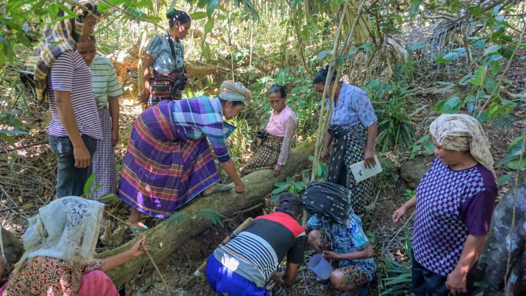
The desire of local communities to protect their precious landscapes is strong, but efforts are stacked against the odds due to unsustainable forest management and weak governance. BirdLife’s Asia-Pacific Forest Governance Project, funded by the European Union, is equipping local
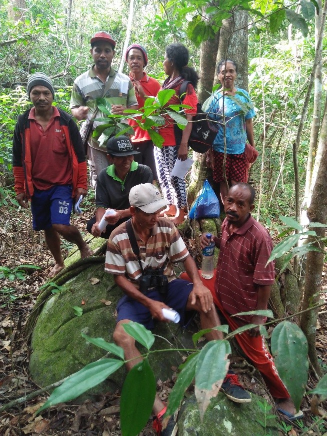
communities with the skills and knowledge to protect and manage their own forests. This includes work on the ground (such as capacity building workshops on governance, monitoring and GPS training), but it is supporting from high above the forest canopy too.
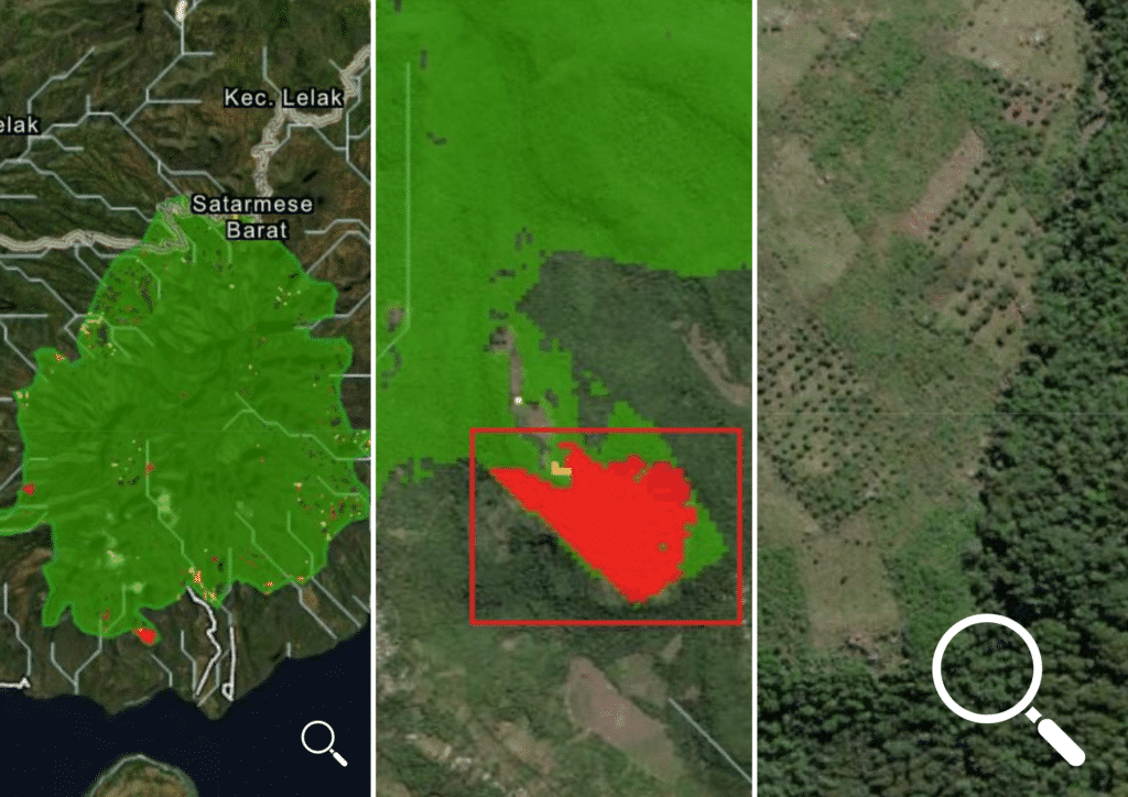
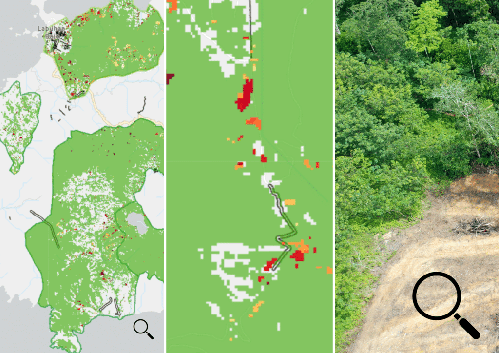
With a bird’s-eye view, satellites allow local users to monitor and analyse forest cover. The project’s new Forest Governance Dashboard provides the information needed to help prevent and reverse deforestation, by combining state-of-the-art remote sensing technology with the invaluable knowledge of local people. The data go all the way back to 2000, painting a picture of how forest coverage has changed in recent decades. At the macro scale, the Dashboard shows forest loss per country and region. Looking closer – down to a 30 x 30 metre pixel – the micro scale highlights forest loss in KBAs, giving an overview of forest loss where on the ground monitoring is difficult and hasn’t taken place. It’s an early warning system that allows project partners to decide how to react and identifies where conservation efforts should be prioritised.
The Forest Governance Dashboard shows:
The most impacted areas: The Dashboard has highlighted the regions in the four project countries that have suffered the greatest forest loss in the past 20 years, notably the Sundaic lowlands of Sumatra, Borneo (including Sarawak and Sabah, Malaysia and Kalimantan, Indonesia) and peninsular Malaysia, which have lost between 22-32% since 2000.
Opportunities for restoration: Java (Indonesia) and the Philippines were identified as regions where extensive forest loss occurred prior to 2000, but where there may be an opportunity for restoration. Haribon (BirdLife in the Philippines) is capitalising on this with its ‘Rainforestation’ programme of replanting native tree species in Irid Angelo, Siburan and Hilong-hilong.
Where to protect: Papua New Guinea and Papua province in Indonesia are shown to have suffered very little loss of forest up to 2019. Here, a conservation priority is to put safeguards in place to prevent future large-scale forest clearance and conversion to plantations.
Header image: Mbeliling landscape, the richest area for restricted-range birds in Flores, Indonesia © Muhammad Meisa / Burung Indonesia
Ground-truthing
Looking into the past enhances our understanding of important trends, but the Dashboard also provides insight into what is happening right now. When a pixel in the image changes, this could mean that trees are being felled, so a user in the area is alerted and can investigate. The information provided from the Dashboard relies on corroboration from ‘ground-truthers’ – satellites may capture the colour and consistency of a canopy, but only people on the ground can confirm what is going on at the roots. Is the darker pixel because of a wind-fallen stand of ancient trees or illegal logging? With an eye in the sky and ears on the ground, forest defenders can react in real time.
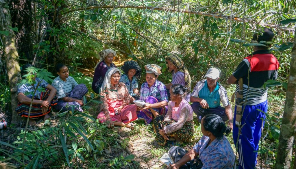
Burung Indonesia (BirdLife Partner) is working within the Mbeliling landscape, a biodiversity-rich expanse of nearly 94,000 hectares on the island of Flores. Here, around the Poco Golo Kempo village, the Forest Governance Dashboard has been instrumental in enhancing Burung’s ability to carry out ecosystem monitoring on the ground.
“Sometimes, when trying to carry out conservation and monitoring tasks in the field, it can be challenging to identify the full extent and overall geography of a KBA or conservation site,” says Tiburtius Hani, Project Co-ordinator, Burung Indonesia. Visuals generated by the Dashboard provide a detailed overview of historical forest loss and rates of subsequent forest conversion at the site. These data alerted the team on the best places to focus their efforts, and field staff and local community groups set out to conduct surveys and ecosystem monitoring. Information collected from the field visits “provided us with the data and real-world observations we needed to compile accurate conservation recommendations for the village government, regarding their future development plans,” says Hani.
This example highlights how technology can support, but not replace, the expertise and presence of local conservationists. The importance of ‘ground-truthing’ by local actors is necessary to confirm or correct the large-scale datasets. In this case, the verified data could be used in a dialogue with the village government to ensure development took conservation into account. With continued updates and refinement, it is hoped that the Forest Governance Dashboard will support actions such as these well into the future.
“On-the-ground monitoring of this kind is undoubtedly a very important part of the mix for forest loss monitoring and conservation interventions, but the Forest Governance Dashboard plays another key role for wider forest governance priorities.”
Poshendra Satyal, Global Forest Policy Co-ordinator, BirdLife International
Local, Better Governance
In Malaysia, 98% of forests are owned by the government – giving them vast power to determine the fate of landscapes. The data and trends made available by the Dashboard will allow Malaysian Nature Society (MNS, BirdLife Partner) to provide concrete evidence to policymakers on the need for greater protection and conservation efforts in biodiversity hotspots and threatened sites. It is hoped that these recommendations will result in sustainable practices and sound forest governance throughout Malaysia, ensuring their diverse habitats are protected well into the future.
With an eye in the sky, the Dashboard turns the hypothetical into reality by providing hard-hitting truths: not simply trends and data on forest loss, but a detailed satellite image to bring home the reality of rare species having their homes torn away. Perhaps its biggest strength, though, is the power and credibility these data give local actors on the ground – bolstering their advocacy and awareness-raising work, including an early warning to urge policymakers to act now to save forests.
More about the project
Title: Strengthening non-state actor involvement in forest governance in Indonesia, Malaysia, the Philippines, and Papua New Guinea
Lead Partner: BirdLife International
National Partners: Burung Indonesia (BirdLife Indonesia); Malaysian Nature Society (BirdLife Malaysia); Haribon Foundation (BirdLife in the Philippines); Tenkile Conservation Alliance (Papua New Guinea).
Training and Technical Partners: University of Papua New Guinea; Centre for International Development & Training
Funded by: European Union
“The Dashboard fulfils an additional role for MNS, in so far as it offers us greater insights into the wider network of the 55 Important Bird & Biodiversity Areas in Malaysia. These datasets, maps and trends on forest loss provide us with evidence-based understanding of the sites that enable us to better plan our policy and advocacy work at local and regional governmental level.”
Balu Perumal, Head of Conservation at MNS
Stay up to date
Sign up to receive the latest bird conservation news. You’ll also receive updates about our projects, science and other ways to get involved including fundraising.
Thank you for your support, we are committed to protecting your personal information and privacy. For more information on how we use your data, please see our Privacy Policy. You can unsubscribe from emails at any time by using the link in the footer of any email from us.