Satellite-tagged seabirds point way to new protected area
Seabirds fitted with satellite tracking devices have revealed a major feeding site previously unknown to science at the heart of the Atlantic ocean. This month, the site – covering an area as large as France – has become the first high seas Marine Protected Area to be identified by remote tracking data.
When it comes to deciding where to locate a protected area, the majority of important habitats are identified by direct observation. Field surveys by scientists or local residents will pinpoint areas of great species richness, vital feeding or breeding sites, or the final strongholds of threatened species. It is far less feasible to sail across thousands of kilometres of remote ocean with a pair of binoculars, scanning the horizons for seabirds that routinely roam hundreds of miles a day. So when BirdLife’s Marine Team set up the Seabird Tracking Database – a collaboration between scientists across the world, bringing together information on thousands of satellite-tagged seabirds – they had absolutely no idea that the birds would lead them to a vital feeding ground of previously unknown importance.
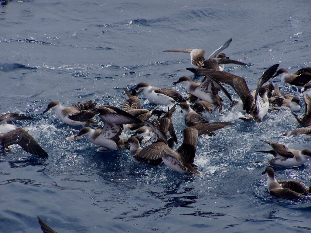
The North Atlantic Current and Evlanov Seamount – or NACES for short – is a treasure trove of species richness and abundance. Bounded on the west by the Grand Banks of Newfoundland and to the east by the Mid-Atlantic Ridge, this is a place where sea currents swirl and stir up nutrients from deep in the ocean. Plankton and fish are bountiful here, so it’s no surprise that the area was found to be a foraging hotspot used by up to 5 million birds of 21 species, many travelling thousands of kilometres to spend the winter there.
Birds from all over the Atlantic converge upon this remote patch of ocean: Bermuda Petrels (Endangered) from their eponymous tropical island, Little Auks from the High Arctic, South Polar Skuas from the frozen wilds of the Antarctic, Great Shearwaters and other globe-spanning ocean wanderers from their scattered breeding islands – this stretch of ocean has it all. Until recently, only the birds knew. But now that we are party to their secrets, what do we do?
Given that seabirds are one of the most threatened groups of vertebrates, and that the majority of protected areas only safeguard them during their brief time breeding on land, our priority was to get this hotspot officially designated as a Marine Protected Area. Proper management can safeguard these waters from the increasing human pressures on the high seas, including fisheries, disturbance and deep-sea mining – benefiting not just birds, but the host of other marine animals found to frequent the waters, such as the Sei Whale, Leatherback Turtle and Blue Shark.
In July, BirdLife published a paper in collaboration with 79 co-authors from across the world providing evidence of the area’s importance. And on the 1st of October, the site – covering an area as large as France – was granted Marine Protected Area status by the OSPAR Commission, which regulates environmental protection in the North-East Atlantic. This makes it first high seas Marine Protected Area to be identified from tracking data.
“This is a big win for the seabirds, and a huge step for our collaborative science influencing conservation policy,” says Tammy Davies, Senior Marine Science Officer at BirdLife.
It’s safe to say that modern technology has expanded our horizons further than ever before, and there are still plenty of new realms for us to explore.
Multi-species tracking reveals a major seabird hotspot in the North Atlantic is published in Conservation Letters.